**Click any picture to see enlarged.**

Day 7 General Route

The image above depicts the section hiked for the day. The YELLOW path is supposed to be the trail based on sources and maps I used to plan my trip, while the RED path is the route my GPS app (GAIA) tracked on my phone. They are fairly close for the most part. More apparent deviations indicate that I either missed the appropriate trail marker, the real trail has alternative routing, or the true trail is not the route highlighted in yellow. The BLUE path indicates my original route planned and the real Slovenian Mountain Trail route.
September 24, 2019
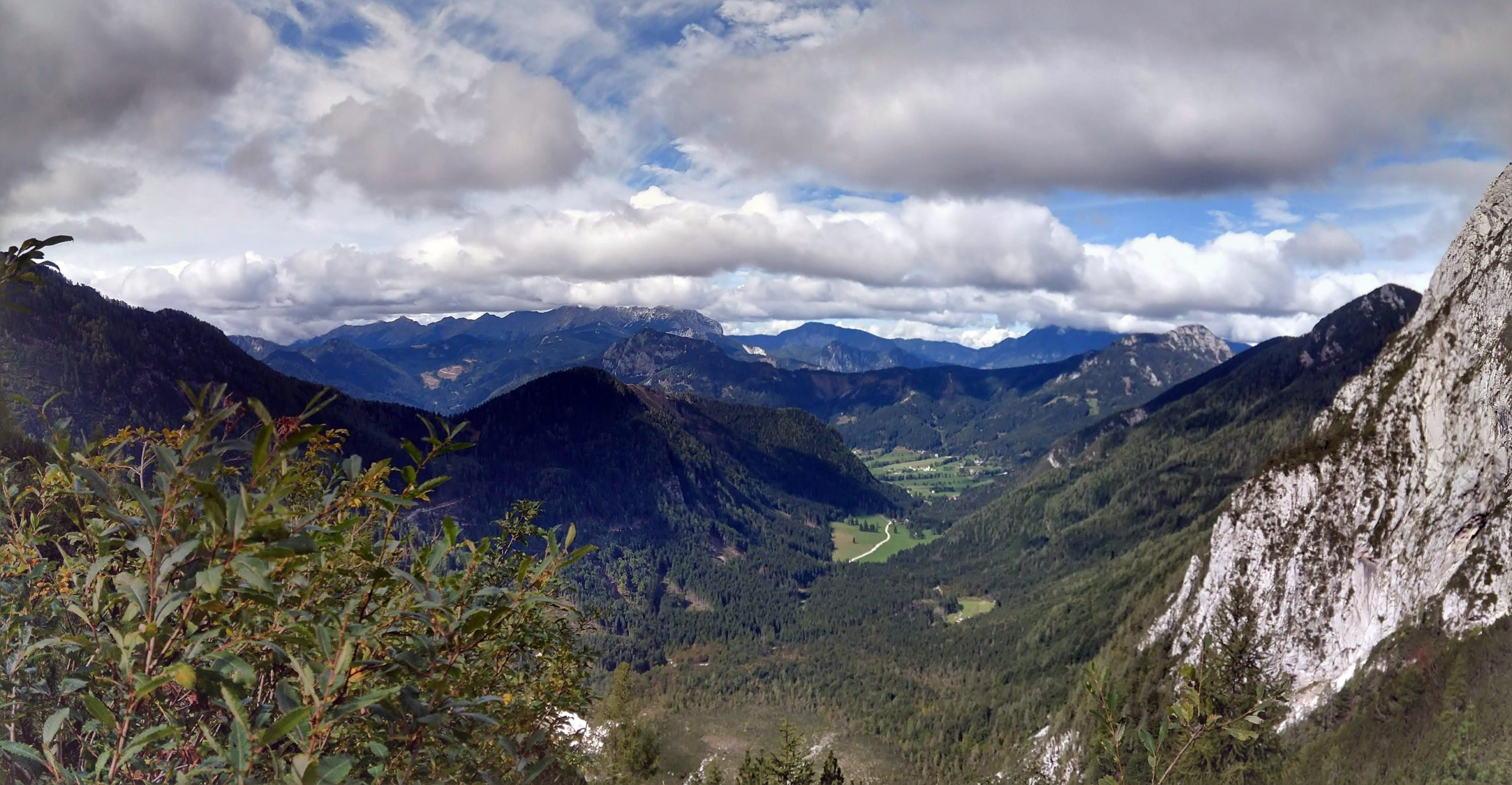
Morning views from Okrešlju now that the clouds and weather had moved on. On a clear day this would certainly be the place to come to have lunch and beer.


Frischaufov dom na Okrešlju– Kranjska Koča na Ledinah (~5.6mile/8.05km)
Segment 1: Route Segment 1: Elevation Profile


We departed the mountain hut around 9AM. The initial portion wonders through some mountain meadows but quickly turns rocky as you increase your elevation. While you head up to Savinjsko sedlo (saddle), make sure to turn around to catch the view of the valley below and surrounding ridges and mountains. With the clear weather today, the views were much better than the rainy evening before.
Along the way you will notice a boulder with several placards dedicated to those who have died. It also looked like some deer or mountain goats roaming around.
Now that we are back on the Slovenian Mountain trail, we will keep following the appropriate trail markings. There are several trail markers indicating the different paths and directions, though they are on rocks and not the usual signage.
Eventually, you will need to scramble up some of the rocks. There are a few spots that have some cabling to assist you on the steeper portions. All in all the route is not bad.


Once you reach Savinjsko sedlo you will see warning signs regarding the Austrian-Slovenian border. During a brief portion (seen below in YELLOW path), you are actually in Austria while you cross a scree slope until you cross Jezersko Sedlo/Seeländer Sattel, which is the opposite mountain pass/saddle (where the RED path picks back up). The rest of the way is down hill to the next Koča. The RED path discontinuity is a result of my GPS tracker app turning off when I took some pictures of the valley below.

While you are in Austria, you can gaze down into the valley below (Belska Kočna/Vellacher Kotschna). The clouds at this point started to come down once I reached the Jezersko sedlo, as you can see in the pictures below. Follow the path and signage to the koča, which is about 40-50minutes away.
As I was descending I could see a small herd of deer or mountain goats, but they were far enough away that I couldn’t get a good picture. While making the final stretch, there was a section that had a cable to maneuver over a section of rock. There were several areas that gave me some caution due to the slickness from the moisture on the rocks. Finally the clouds lifted to view Ravenska Kočna (valley below).
After about 30 minutes, I reached the alpine rescue shelter. From here Kranjska koča na Ledinah is less than 10 minutes away.


Kranjska Koča na Ledinah
I arrived at Kranjska koča na Ledinah around 1200, but the Koča closed. I decided to drop my pack and wait for the other hiker. It was also an opportunity to take my boots and socks off, drink more water and observe my surroundings. With the clouds low, I couldnćt really capture anything great but was able to see through portions of the less dense clouds.


If you look up to the south of the lodge, you are looking at the north side of Skuta. While reviewing my map and possible routes, the other hiker arrived. We discussed our next moves while eating some food. At this point, we would part ways on our journey.
My next section would not continue on to Češka koča na Spodnjih Ravneh, as I had originally planned. Due to the timing and how many miles I still had left to reach Dom pod Storžičem, I needed to bail and head down to Zgornje Jezerko via Ravenska Kočna. The route looked more manageable. I decided there would be another trip in which I could spend more time in the Kamniško-Savinkske Alpe section of the hike.
Kranjska Koča na Ledinah – Zgornje Jezersko (~4.49mile/7.23km)
Segment 2: Route Segment 2: Elevation Profile


Around 1300, I loaded up my gear and to begin my descent to Zgornje Jezersko. The view going down was spectacular though very steep in several areas. I did not take nearly as many pictures since I needed my focus, but the views were quite memorable. The entire descent I kept looking to up at the western face of Ledinski Vrh. The views down were also dramatic.
As I approached the valley floor the dried up river bed of white crushed stone began to get larger. On the descent I could also look westward toward Češka koča na Spodnjih Ravneh and was assured that I had made the right call to take the current route.
Once I had reached the end of the white rock flow, I was able to find the signage that directed me toward a road. From the road, I followed more signage to get to the main road go to Zgornje Jezersko.
During this section, I passed through a large open pasture with more cows. At this point, I had also started to jog. The road was decent and I needed to make up some time while I the conditions were favorable. This explains the lack of pictures covering this section.
Ravenska Kočna Ravenska Kočna Ledinski Vrh Ledinski Vrh Lovska družina jezersko


Eventually, the road connected to route 210 just past Planšarsko jezero, which also had a restaurant on the lake. In hindsight this might have been a good place to stop and get some food, but I had figured that something would be open further down the road, closer to Zgornje Jezersko.
As I walked along 210, maintained as faster paced walk. This portion was excellent in that I could view the surrounding mountains and ridgelines, though the clouds continued to rise and fall giving sporadic mountain views.
Zgornje Jezersko – Turnaround (Storžic) (~3.58mile/5.76km)
Segment 3: Route Segment 3: Elevation Profile


Zgornje Jezersko to Exiting Road 210
I arrived in the Zgornje Jezersko area just around 1510. The information center was closed as were several other places. This was quite disappointing, especially since the grocery was not open as well. Due to the timing, I did not linger around. This would also be another area to take additional time to explore on another trip. Clouds were low as well so mountain views were limited.
Once I passed the town center area, I continued along the road for about 2.13 miles (~3.42 km). While I was passing through town, I did call Dom pod Storžičem to make sure they were open for overnight stays. Had I not received confirmation, I might have tempered my ambitions for the day and spent time looking to see what was open for the night.


Once I reached Penzion Kanonir/Gostišče kanonir Marija Jokić s.p., I turned off of road 210 and crossed the bridge. The image below is linked to the Google StreetView URL so you can explore yourself. Had the restaurant/pension been open, I might have stopped for food and maybe to stay the night. I was already feeling pretty exhausted and was ready to be done for the day. At this point I did call Dom pod Storžičem to indicate that I was on my way and gave a rough estimate for when i would arrive.

Exiting Road 210 to Turnaround Point
On this next section, I just followed the road and signage. Initially you pass by several homes and open fields but quickly turns into a forested gravel logging road. There was a creek/stream next to the road for the most part.
About 1.95miles/3.15km down the road, I stopped to refill my water before the water source became more difficult to get to or possibly not accessible. It was a good thing I had my water filter with me, though this was the one of the few times I actually used it.


Another mile or so up the road, the trail splits off from the road. This is where the trail really increases its ascent in elevation up to the Bašeljski preval (saddle). After making my way up the trail, I came to the Javorniški preval intersection. I didnt have solid information about this trail but based on my offline map it looked like a possible alternative that followed along a contour line to a shoulder point and then to Dom Pod Storžičem.
Instead, I decided to scope out further up the trail so I continued on to the Bašeljski preval. After a short stretch, I arrived at Bašeljski preval around 1800. This means it took roughly 3 hours to get here from Zgornje Jezersko.

Base on my estimates it would take at least 2hrs to get to up and over Storžič. I was already in an exhausted state by this point. After constantly assessing the time and the potential danger of descending from Storžič at night and increased cloud cover, I decided to turnaround after a short distance up. This was my bail point marked on the map. I would attempt the Javorniški preval route.
With no else around, I was really on my own. I was already cutting my margin of safety pretty close. This is not the position you want to be in, but you do have to make do with what youself get into.
Turnaround – Dom pod Storžičem (~3.58mile/5.76km)
Segment 4: Route Segment 4: Elevation Profile


While I made my way back to the Javorniški preval intersection, I assessed that the route would take another hour and a half. This meant I would be completing the day in the dark. You have to weigh the risks, but this alternative route looked like the best option with a reduced amount of potential risk. I attempted to call the mountain hut by I didnt have signal.
Below are the last images of the day from hiking as I get ready to cros Javorniški preval. This should give an idea of the clouds and available light just before making the traverse.


The 1.86mile-3.6km stretch to the shoulder-saddle would likely take an hour so i estimated I would get there around 1900-1930. As I made the traverse, I ran out of water about two thirds of the way. Not great. I also started to cramp up in my calves. Also not good.
To add more good news, I was under the tree canopy so there was no more ambient light available. I donned my headlamp for the rest of the way. Along the way, I tried to stretch my calf and thigh to reduce the cramps. I did pop a couple more of the Cliff Bloks (Amazon link) to help take in some more calories and electrolyte to hopefully help out. I had been taking them throughout the day to helpfully mitigate cramping issues.
Once I got to the shoulder/saddle area, I could tell I was on a forest road. This was positive in a sense because had made it. I also noticed that I had cell signal again, so I made a call to the mountain hut hosts to confirm where I was and roughly 45minutes away. At this point it was around 1930, which was later than I expected.
I started walking fast down the road, checking my map frequently to make sure I was on the right track, and to check my remaining distance. At various segments along the road, I did jog some to expedite the process. Eventually i could see some lights on a building and knew I was at my destination.
The time at this point it was around 2000. That final segment from the shoulder to the mountain hut took about 20min to cover, though I had estimated 45 minutes. Much better but now was time to relax, stretch, rehydrate and eat.
Daily Hiking Stats
- Total Distance: ~17.37miles / 27.96KM
- Estimated Elevation Gain/Loss: +2146ft / -2395ft
- Total time hiked: ~11 hours (1hr 15min break)
Evening at Dom pod Storžičem
Always call when there is signal if you think you’ll be late to a koča or to see if they are even open. Had I not learned that lesson on an earlier day in the trip, I might have come up short this night. Instead, I was welcomed by the hosts and had something to eat and drink. I was able to relax in the comforts of the mountain hut.
Below was my dinner of ričet with klobasa, bread and beer. There was nothing left when I finished..
Ričet with Klobasa

Current Trip Costs
The total daily cost was 32.6 EURO.
- Transportation: 0 EURO
- Food: 8.6 EURO (breakfast only); dinner was included in lodging/boarding cost
- Lodging: 24 EURO
- Running Total Cost: 958.34 EURO
Previous Slovenia Posts
- Trip Planning: Slovenian Mountain Trail, part 1
- Slovenia Trip: Pre-Hike Days
- Slovenian Mountain Trail: Day 1
- Slovenian Mountain Trail: Day 2
- Slovenian Mountain Trail: Day 3
- Slovenian Mountain Trail: Day 4
- Slovenian Mountain Trail: Day 5
- Slovenian Mountain Trail: Day 6
- Slovenian Mountain Trail: Day 7
Useful Links
- Okrešlju
- Kranjska Koča na Ledinah
- Zgornje Jezersko
- Dom pod Storžičem
- Very Useful offline map app of Slovenia (android link): https://play.google.com/store/apps/details?id=org.mapapps.mapyourtown.slovenia&hl=en_USGAIA App (android link): https://play.google.com/store/apps/details?id=com.trailbehind.android.gaiagps.pro
- Google Fi Phone Service: referral link
- Resources for learning Slovene
- https://www.slonline.si/ (great resource, free)
- Colloquial Slovene Book: Amazon Referral Link
- Colloquial Slovene Book-Audio clips: https://www.routledgetextbooks.com/textbooks/colloquial/language/slovene.php
- https://www.thinkslovenia.com/info-activities/slovenian-language-learning

