**Click any picture to see enlarged.**

Day 6 General Route

The image above depicts the section hiked for the day. The YELLOW path is supposed to be the trail based on sources and maps I used to plan my trip, while the RED path is the route my GPS app (GAIA) tracked on my phone. They are fairly close for the most part. More apparent deviations indicate that I either missed the appropriate trail marker, the real trail has alternative routing, or the true trail is not the route highlighted in yellow. The BLUE path indicates my original route planned and the real Slovenian Mountain Trail route.
September 23, 2019
7AM wake up and out of the room before 730AM. The pictures below of the room I stayed in show a very simple place to sleep but comfortable enough for my needs. Breakfast (zajtrk) was again bread with a selection of nutella, honey, jam and butter and a couple cups of coffee. After settling up my bill, I headed out with the other hiker.
Koča v Grohotu pod Raduho


Koča v Grohotu pod Raduho – Solčava (~5.6mile/8.05km)
Segment 1: Route Segment 1: Elevation Profile


We departed the mountain hut around 8:30AM. It wasn’t raining but it certainly felt like it would any moment. On the way down the mountain side to the valley below, there were several peekaboo spots to observe the surrounding landscape, but a large portion of the route was through the woods.
About halfway down we popped out in a field and began walking along the road (following the trail markers). It was here where you could look back at Raduha with a little more standoff to observe the north face of the mountain. Part way down we came upon some cows that seems curious about our purpose as we continued to walk along the road.


Once the road we were on intersected with the primary road to Solčava, we headed north. Then we started seeing more and more buildings as we entered the small mountain town of Solčava.
Partizan Memorial The parish church of St Marija Snežna


Solčava – Logarska Dolina (~4.49mile/7.23km)
Segment 2: Route Segment 2: Elevation Profile


We stopped off at the tourist information center just before 11AM to get some info on the trail and conditions ahead along our intended route for the day and to see if there was a potential alternative to get up and over the mountain in case the weather got bad. The Information Center was very helpful and they had some maps, but the maps they had didn’t have as much detail on some of the hiking routes. We departed around 11:15AM.
Along the way it sprinkled a little bit. About 1.3 miles down the road, we arrived at Gostišče in muzej Firšt with the idea that we would get lunch here, but it was closed as was Prenočišča Valentina. We sat at one of the tables to eat some food before continuing on. From Solčava to here was pretty flat with a slight incline but walking on the pavement was starting to make the feet ache.
Gostišče in muzej Firšt Prenočišča Valentina


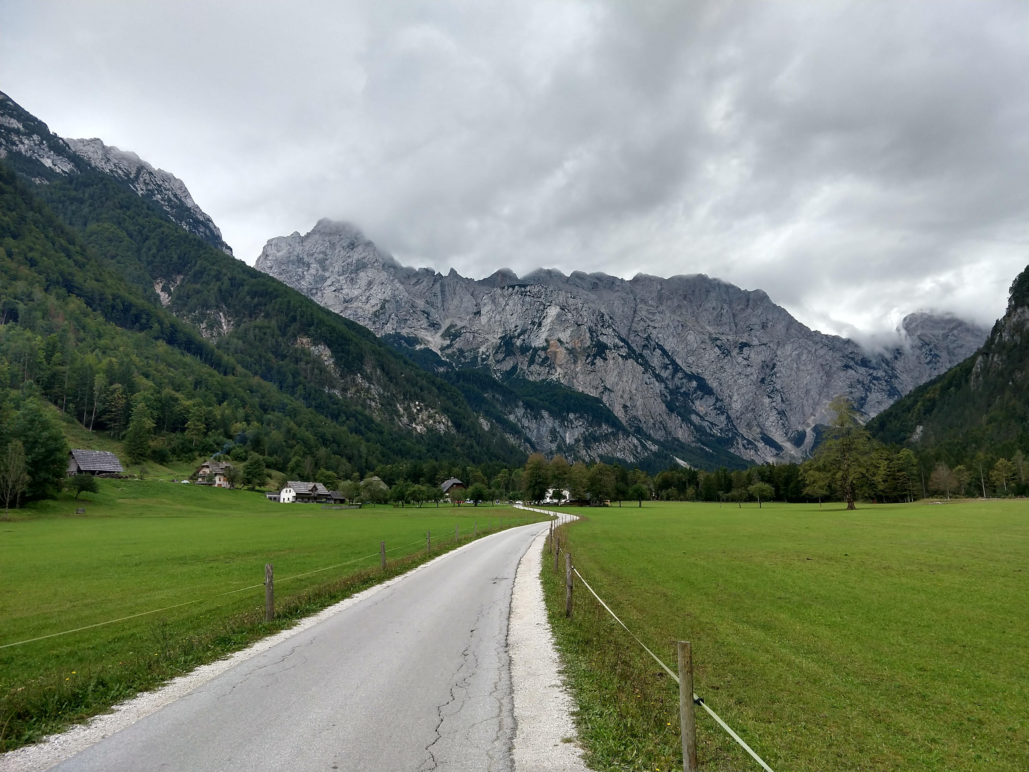
After departing from our short break the road began to increase in elevation, but not significantly noticeable, until we got to the opening on the northern end of Logarska Dolina, which then began to level off. We stopped off at the entrance hut to talk to the folks there, then proceeded along the road. This was about 2.7miles from Solčava. There were several building scattered throughout the valley and a lot more cows.
Logarska Dolina (Logar Valley)

Over the next 1.5miles, we walked on the road, observing what the valley had to offer. At various points the clouds held up enough for the sun to peak through, providing some better light, but the clouds on the southern end of the valley were still pretty low laying. Along the way we checked to see what places were open that had food available. Eventually we arrived at Penzion kmečka hiša Ojstrica, which is the last major clearing for open farm land before entering the woods.
Entrance of Logarska Dolina Logarska dolina Spirituality Center Ojstrica (tallest left of center) Hotel Plesnik


Logarska Dolina
When we arrived around 1325, Domačija Plesnik was not open, but the place across the street, Penzion kmečka hiša Ojstrica, was. We decided to just get some lunch here and take a break. During lunch we sat out side under some patio umbrellas and of course it started to rain, so we lucked out on timing of our break. Lunch was ham, sauerkraut, potatoes, salad and tea (caj). Lunch was good but more expensive than my previous meals at traditional mountain huts along the way.
Penzion kmečka hiša Ojstrica Domačija Plesnik Ham, sauerkraut and potatoes


Logarska Dolina – Frischaufov dom na Okrešlju (~3.58mile/5.76km)
Segment 3: Route Segment 3: Elevation Profile


When we departed the restaurant around 1438 it wasn’t raining, but no less than 5 minutes later it was raining as we began approaching the wooded portion that would extend to the base of the mountain. As we continued along the road, it began raining harder and harder. Thank goodness I brought that umbrella. Funny enough the other guy brought an umbrella as well as a lesson learned while hiking the Continental Divide Trail.
There was a mountain hut (Dom Planincev) part way up the road, but it was closed due to the season. We waited under the front overhang for a bit to check to see if the weather was going to improve or not, as well as discuss whether we should continue or wait longer. We inevitably continued as it looked like there was another building at the end of the road where the trail picks up.
Once we arrived at the end of the road just before 1600, we lucked out with the massive roof to provide shelter from the rain. We dropped our gear and began to hang out and ask a few of the hikers coming off the trail information about how far (time and distance) to the next building at the waterfall (Rinka Slap)l. Also the services at the building were closed, but the bathroom building was open and working. We could could have easily slept under the roof for the night if we had to.


After waiting about 50 minutes under roof, the weather looked to be clearing up a little and the radar forecast indicated we might have about 40 or so minutes before the next weather system was coming through. We figured it would take 1-1.5hr, maybe two depending on weather, to get to the mountain hut at Okrešlju.
We reached the waterfall within 15min or so then proceeded up the rocky trail. The rain was holding off pretty well and we were able to get some pictures along the way. We saw several of the black alpine salamanders, pictured below. There were several wood plank crossings and lots of stairs. It was a good thing there was a cable for a railing though to keep balance. After we got to the top, the trail leveled out some, but then it started to rain again. At least the hard part was behind us. This last stretch took maybe 10minutes. Finally, we arrived at Okrešlju around 1745, which means it took around 1.25hr to get up here from the end of the road.


Daily Hiking Stats
- Total Distance: ~13.67miles / 22KM
- Estimated Elevation Gain/Loss: +5078ft / -5349ft
- Total time hiked: 9 hours 9 minutes (1hr 13min mid-day break, ~50min break waiting for rain to pass)
Relaxing Evening at Okrešlju
We were the only hikers at the mountain hut but the hut was still open and the host was just hanging out. After dropping our gear and making arrangements for the night, as well as food and drink. We hung up our clothes and boots in the warm room, where they have a stove-furnace covered in ceramic tiles that really retain the heat.
Dinner was golaž with strudel for desert. Very good after being cold, wet and exhausted.
During the evening we plotted out our next days hike. This would be were we would likely begin to deviate due to our separate timelines and such as well. My desired end spot for the next night was Dom pod Storžičem, which was a lot further away. Luckily the weather was looking more promising for the day ahead as well.
While we were chatting with the lodge host, I decided to try the different liquors I had been seeing around, namely the smrekov(spruce) and boroničev (blueberry) likers, which are schnapps/brandy.
Outside seating Okrešlju Entrance dining room dining room dining room dining room Outside seating Bunkhouse


Side note:
After returning from my trip, there was an accident at Okrešlju, which caused it to burn down around 6-7 November 2019. From the reports and pictures, most of what I took a picture of is all gone and all that remained was the stone, metal and concrete structure. Apparently a fire caused by a fault in an electric installation, per investigation. The facility had recently been renovated as well.
Info on the mountain hut below:

Slovenian-English Translation
- Zajtrk = Breakfast
- Dolina = Valley
- Slap = Waterfall
- Smrekov liker = Spruce schnapps
- Boroničev liker= Blueberry schnapps
- Caj = tea
Current Trip Costs
The total daily cost was 58.89 EURO.
- Transportation: 0 EURO
- Food: 42.3 EURO
- Lodging: 16.59 EURO
- Running Total Cost: 925.74 EURO
Previous Slovenia Posts
- Trip Planning: Slovenian Mountain Trail, part 1
- Slovenia Trip: Pre-Hike Days
- Slovenian Mountain Trail: Day 1
- Slovenian Mountain Trail: Day 2
- Slovenian Mountain Trail: Day 3
- Slovenian Mountain Trail: Day 4
- Slovenian Mountain Trail: Day 5
- Slovenian Mountain Trail: Day 6
- Slovenian Mountain Trail: Day 7
Useful Links
- Koča v Grohatu/Koča na Grohatu
- https://www.pzs.si/koce.php?pid=95
- http://www.hribi.net/gora/koca_na_grohatu/3/615
- http://grohot.eu/grohot/
- Solčava
- Logarska Dolina
- Okrešlju
- Very Useful offline map app of Slovenia (android link): https://play.google.com/store/apps/details?id=org.mapapps.mapyourtown.slovenia&hl=en_USGAIA App (android link): https://play.google.com/store/apps/details?id=com.trailbehind.android.gaiagps.pro
- Google Fi Phone Service: referral link
- Resources for learning Slovene
- https://www.slonline.si/ (great resource, free)
- Colloquial Slovene Book: Amazon Referral Link
- Colloquial Slovene Book-Audio clips: https://www.routledgetextbooks.com/textbooks/colloquial/language/slovene.php
- https://www.thinkslovenia.com/info-activities/slovenian-language-learning

