**Click any picture to see enlarged.**

Day 3 Route

The image above depicts the section hiked for the day. The YELLOW path is supposed to be the trail based on sources and maps I used to plan my trip, while the RED path is the route my GPS app (GAIA) tracked on my phone. They are fairly close for the most part. More apparent deviations indicate that I either missed the appropriate trail marker, the real trail has alternative routing, or the true trail is not the route highlighted in yellow.
September 20, 2019
The alarm went off at 7AM. Even though I got some much needed rest, my body was still exhausted from the 40+miles just hiked. I made my way down for breakfast and coordinated a late checkout with the front desk in hopes of walking around the town some and maybe catching a nap before setting out. The night before I decided I would make today half as short so there was not the demand to get hiking right away.
Breakfast was an assortment of bread, meats, some eggs, juice and coffee in the Hotel’s breakfast area. I made sure to get some much needed calories in my body just in case I ran into anymore issues the rest of the day. After 30minutes or so, I set out to walk about the town without anything but my camera.
The following are samples of the morning views.
Breakfast The parish church of St. Elizabeth of Hungary The parish church of St. Elizabeth of Hungary The parish church of St. Elizabeth of Hungary The parish church of St. Elizabeth of Hungary


Following my walking around, I stopped in at the Tourist Information Center and was able to pick up a Slovenian Mountain Trail Passport for 3.50 EUR. After making my way back to my room, I repacked all my gear so it would be ready to grab and go following a quick nap.
Slovenj Gradec – Poštarski dom pod Plešivcem (~5.18mile/8.34km)
Day3 Segment 1: General Route Day3 Segment 1: Elevation Profile


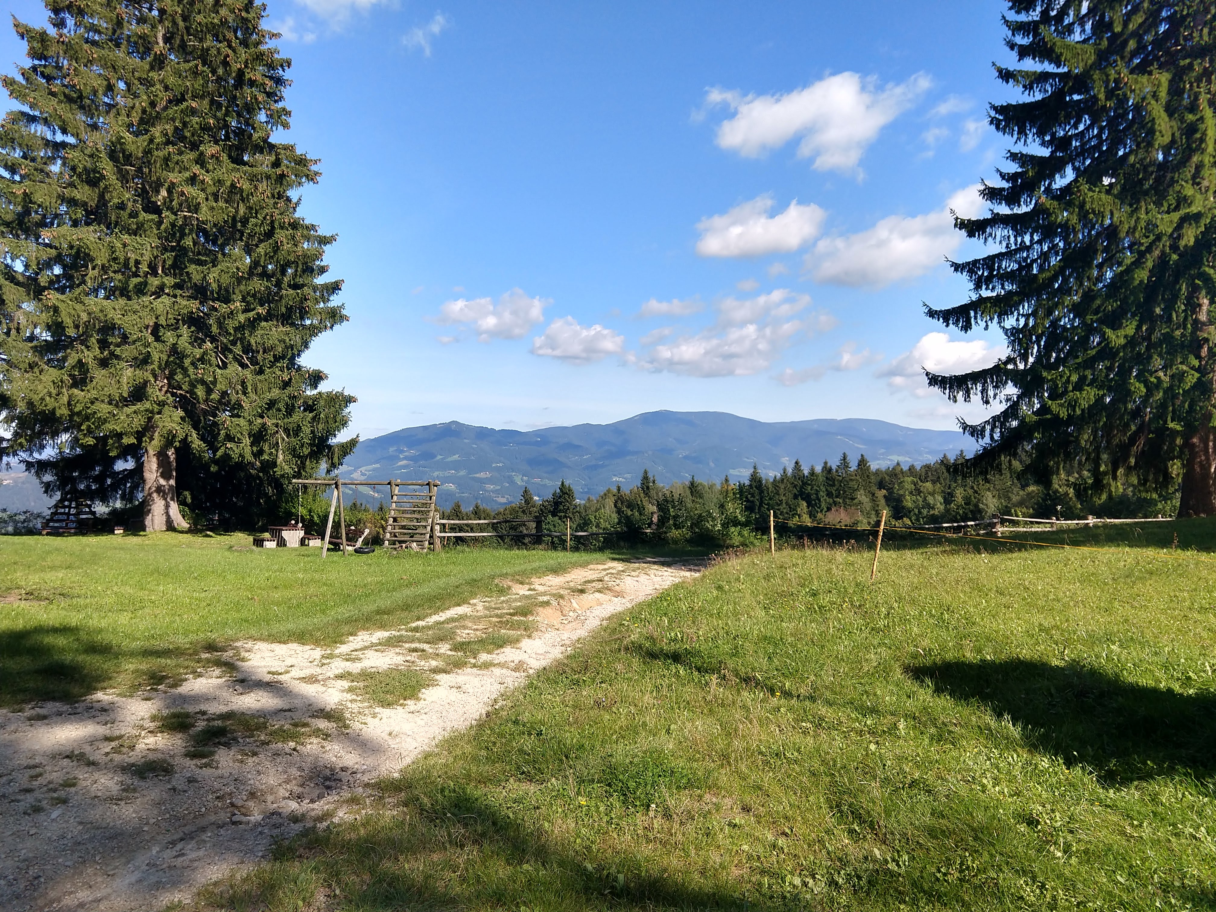
I departed Hotel Slovenj Gradec around 1140AM, heading southwest along Glavni Trg to the roundabout and continuing on Podgorska cesta until you get to Muratova ulica (first picture in gallery below). From here you’ll notice the trail makers a little more clearly on fences, buildings and light posts. From the path that passes by some farm fields, you get some amazing 360 views of the surrounding mountains since you are in the valley between the Pohorje and Koroška.
You’ll walk through a section of town before passing by some church buildings (St Radeguna). From the Church and a few mini-Chapels, you’ll make you way up through a small valley until you reach a paved road. This paved road will take you past a series of houses of varying designs. The trail signs are noticeable and lead you to a restaurant just before crossing the road to pick up the trail again.
St Radegunda St Radegunda Restaurant


After walking along the side of the road for a little bit past the restaurant (Restavracija na Klancu) at the intersection (3rd from last picture above), the trail begins to enter into the woods. This trail eventually comes out overlooking rolling farm lands. From here you’ll walk down the road to the intersection. Along this stretch you’ll begin to see the broadcasting tower on Uršlja Gora to the west.
While walking passing through the hamlet you’ll see an old church then re-enter some woods and pop out to an open field shortly after. The trail returns back to the paved road again, which you’ll follow past the Church of St. Roka (Cerkev Sv. Roka). The signs and markings are apparent, even along the road. By this point it seemed quite different to be walking on a paved road versus being on a hiking trail but it is what it is. The route certainly provides you with a glimpse of different living environments across the country.
As you make your way up the road more and more, the views to the north (west to east) provide some excellent scenery with the valley and the western end of the Pohorje.
Church of St. Roka Church of St. Roka Church of St. Roka


Poštarski dom pod Plešivcem – Dom na Uršlji Gore (~3.82mile/6.15km)
Day3 Segment 2: General Route Day3 Segment 2: Elevation Profile


I arrived Poštarski dom pod Plešivcem around 1430, but the doors where closed and locked. I didn’t understand the note on the door so I just took a short break outside. Before leaving, with the sky so clear it was nice to look back on where I had been the day before (last picture in gallery)
Poštarski dom pod Plešivcem Poštarski dom pod Plešivcem Panorama Uršlja Gora and surroundings Looking North-East (where I hiked day before)


Around 1450, I departed Poštarski dom pod Plešivcem for the final segment of hiking for the day. On the map segment above you’ll notice that the red GPS route is different from the yellow route. The sign indicates both are valid but I wanted to take the one that would be mostly trail versus road.
The rest of this segment would be mostly uphill, partly on gravel/forest road and part on foot trail, which was quite a thigh burner in several parts. By this point in the trip it seemed as though switchbacks were not considered during trail development unless there was no way to continue going up on the trail. This segment was about 3400ft in elevation gain over the ~3.8miles.
Along part of the gravel road, the view opened up where you could get a great panoramic view to the north. Most of the trail was forested and had no substantial views besides the immediate surroundings. There were a few more shrines, a couple bench and a memorial.
As you approach the clearing along the ridge leading you to Uršlja Gora, you can see the church at the top (as seen in photo below). Once you are on the ridge the views open up significantly and there are a few look out points to take advantage of before getting to the mountain hut.
Drinking water Panoramic View to the North Dom na Uršlji Gore


Uršlja Gore
I arrived at Dom na Uršlji Gore at 1700. The sky was pretty clear and the temperature was starting to come down. After dropping off my outside, and changing into sandals to allow my feet and boots to air out for the rest of the evening, I headed inside to make arrangements with the mountain hut hosts in the dining area for a room.
I ordered my first beer of the evening and sat at the table to relax and review my hiking book and map. The beer on tap was Carlsberg, a non-Slovenian beer, though they had bottles of Laško. There were a few folks inside marking off some groups as they made their way into the lodge, in what looked like some team hiking event. When my room was ready I went up to drop off my pack. Little did I know the night was just beginning.
The following pictures give some views of the interior of the mountain hut, including the room I’d be staying in.
Room for the night Church of St. Ursula Coffee to perk up


Daily Hiking Stats
- Total Distance: ~9.7miles / 15.61KM
- Estimated Elevation Gain/Loss: +5487ft / -1442ft
- Total time hiked: 5 hours 20 minutes
Relaxing Evening at Uršlja Gora
Little did I know when I first arrived, that would night would be very eventful and a great experience to add to the trip. First, I set out to scope out the area outside the mountain while there was still plenty of day light. I sat outside at one of the benches to drink another beer and take in the views of the lower valley and surrounding mountains. While sitting there I struck up a conversation with one of the hikers who was part of the group. He started speaking in Slovene but I was quick to let him know my Slovene wasn’t good and asked if he spoke English (some of the phrases I learned to say in Slovene), to which he quickly switched.

We got to talking about their team building event and what they do, as well as where I was from and what I was doing in Slovenia. It turned out they do business in the US. He mentioned the group would be staying at the hut for the night as well and we could continue later.
Church of St. Ursula
When he left to grab a beer and chat with the other folks in his group, headed over to tour the Church of St. Ursula (Cerkev svete Uršule) which is just outside the mountain hut.


Night Time at Uršlja Gora
After touring the Church I headed inside the mountain hut to get some food. By this time the temperature was dropping with the diminishing light. I ordered goulash (golaž), which is a more typical menu item at most mountain huts and would be common for me to have for most dinners the rest of the trip on the trail. The serving size was very generous and appreciated given my continued calorie deficit.
goulash with bread (typical dinner for me most nights)

Following my dinner, the guy I talked to earlier invited me to join their company party. The rest of the night was filled eating, drinking, socializing with the group, sharing stories, listening to music and even singing. This was a very lively and enjoyable group to run into at the mountain hut and added to the cultural experience. At one point they played Take Me Home Country Roads by John Denver on guitar and sang it in Slovene, as well as traditional Slovene music with an accordion that was at the lodge.
Before heading to bed, I did make it outside to check out the night sky and look out at the valley below. The temperature had dropped quite a bit at this point and was glad to be staying inside.
Lessons Learned
- This portion of the trip went very well.
- If you need to withdraw money before heading on the trail, there is a bank and ATM in Slovenj Gradec near Hotel Slovenj Gradec.
- With additional experience with mountain hut being closed, make sure you have food on hand to cover you to the next place.
Slovenian-English Translation
- Gore/Gora = Mountain
- Cerkev = Church
- Gostilna/Gostišče = inn/pub, eating place, guest house
- Pot = path or way
- golaž = goulash.
- A typical stew of meat and vegetables with assorted flavors and spices served at most mountain huts.
- soba = room
- cenik = price list (menu)
Current Trip Costs
The total daily cost was 32.30 EURO.
- Daily Transportation: 0 EURO
- Daily Food: 15.30 EURO
- Daily Lodging: 13.5 EURO
- Slovenian Mountain Trail Stamp Passport: 3.50 EURO
- Running Total Cost: 785.50 EURO
Previous Slovenia Posts
- Trip Planning: Slovenian Mountain Trail, part 1
- Slovenia Trip: Pre-Hike Days
- Slovenian Mountain Trail: Day 1
- Slovenian Mountain Trail: Day 2
- Slovenian Mountain Trail: Day 3
- Slovenian Mountain Trail: Day 4
- Slovenian Mountain Trail: Day 5
- Slovenian Mountain Trail: Day 6
- Slovenian Mountain Trail: Day 7
Useful Links
- Slovenj Gradec Info:
- Koroška Tourist info
- Very Useful offline map app of Slovenia (android link): https://play.google.com/store/apps/details?id=org.mapapps.mapyourtown.slovenia&hl=en_USGAIA App (android link): https://play.google.com/store/apps/details?id=com.trailbehind.android.gaiagps.pro
- Google Fi Phone Service: referral link
- Resources for learning Slovene
- https://www.slonline.si/ (great resource, free)
- Colloquial Slovene Book: Amazon Referral Link
- Colloquial Slovene Book-Audio clips: https://www.routledgetextbooks.com/textbooks/colloquial/language/slovene.php
- https://www.thinkslovenia.com/info-activities/slovenian-language-learning

