Summary
Sunday late afternoon hike along the Hannegan Pass Trail and up to Hannegan Peak in the Mount Baker Wilderness of the Mt Baker-Snoqualmie National Forest in the North Cascades. This is an easy to moderate, non-technical hike. The trail gains elevation gradually initially, but gets more pronounced as you get closer to Hannegan Pass and up to the Peak. The trail has several small creek crossings. The entire hike offers panoramic views of the surrounding ridges and peaks up through the valley. At the Peak, you get excellent 360 views of the North Cascades region. There was intermittent snow from just before Hannegan Pass through to the Peak. Microspikes would be advised, but maybe not necessary for most parts. The roughly 10.6 mile round-trip took about 5 hrs.
(All pictures are clickable for larger views.)
Route Overview
Expand for more details

General Route


In the above general route outline, the yellow was roughly our route. The trail is clearly defined the entire way until the last 0.3 miles. Snow tracks might be visible.
I used the Gaia app to track my return route to help outline the general route depicted above.
Washington Trail Association Links:
- Hannegan Pass/Peak
Appropriate Maps:
- National Geographic Maps:
- Mt Baker, Boulder River Wilderness Area, Mt Baker-Snoqualmie National Forest #826
- This provided a good overview of the area/surrounding area, but would not be practical for the details of the trail.
- Mt Baker, Boulder River Wilderness Area, Mt Baker-Snoqualmie National Forest #826
- Green Trails Map:
- Mount Baker Wilderness, Map 13SX *** Best Map for the Hike ***
- This was the best map for this hike and area. There is a lot more fidelity to the trail features and switchbacks.
- Contours are much easier to see.
- Mount Baker Wilderness, Map 13SX *** Best Map for the Hike ***
Overall Difficulty:
Easy to moderate. The initial trek through the valley from the parking lot is an easy grade but eventually gains some elevation up to Hannegan Pass and on up to the Peak. Decent of elevation gain. Not much snow until the last 0.3 mile, which is on mostly steep terrain.
Gear Load-out:
Expand for more details
- Osprey Talon 33L [Amazon Link]
- Microspikes [Amazon Link]
- 3L Hydration Reservoir [Amazon Link]
- First Aid Kit
- Compass
- Map [Amazon Link (Green Trails)]
- 1x pair extra socks (Darn Tough) [Amazon Link]
- Food
- Light Rain Jacket
- Light-weight warming layer
- Gloves (see Layered Glove post)
Getting to the Trailhead:
Expand for more details
From the Glacier Public Service Center, drive east along WA-542 for about 12.8 miles. When you get to the WADOT facility (on left), its about 0.3 after that on your left. The turn off is a quick left turn just before the bridge and could easily be missed if you are going too fast. The corner also makes it difficult to see oncoming traffic as you cross the road onto NF-32. If you drive over the bridge or get to Silver Fir Campground area, turn around and drive back a short distance. The bridge is the prominent feature.
Once you are on NF-32, continue to drive about 5.1 miles. You will pass the Nooksack Cirque Trail Road sign about 1.3 miles and the Goat Mountain Trailhead at 2.4miles. Continue past the “Road Damaged” sign. The current trailhead parking area is apparent. Due to a road washout, parking is before the actual trailhead. There is somewhat plenty of parking but it really depends on how much space people think cars need. Park smartly so others can enjoy the trail as well. There is a bathroom structure at the trailhead but may not be as maintained as the one at Goat Mountain Trailhead.


Google Maps Directions:
From the Glacier Public Service Center to the Hannegan Pass Trailhead (click here)
Vehicle Clearance:
I drove a truck with no issues. You could take a lower clearance vehicle but watch out for the deep and numerous potholes. The potholes shouldn’t be an issue to straddle or drive around them if you have a low clearance vehicle. The road is also generally wide enough in most areas for 2 way traffic. In the areas were the road is more narrow there are plenty of small pull-off areas in both directions. Once past Goat Mountain trailhead, the road is more narrow in several areas. There is a sign at the upper Goat Mountain Parking lot indicating limited turnaround areas. The road is still good, but not ideal for vehicles with trailers.
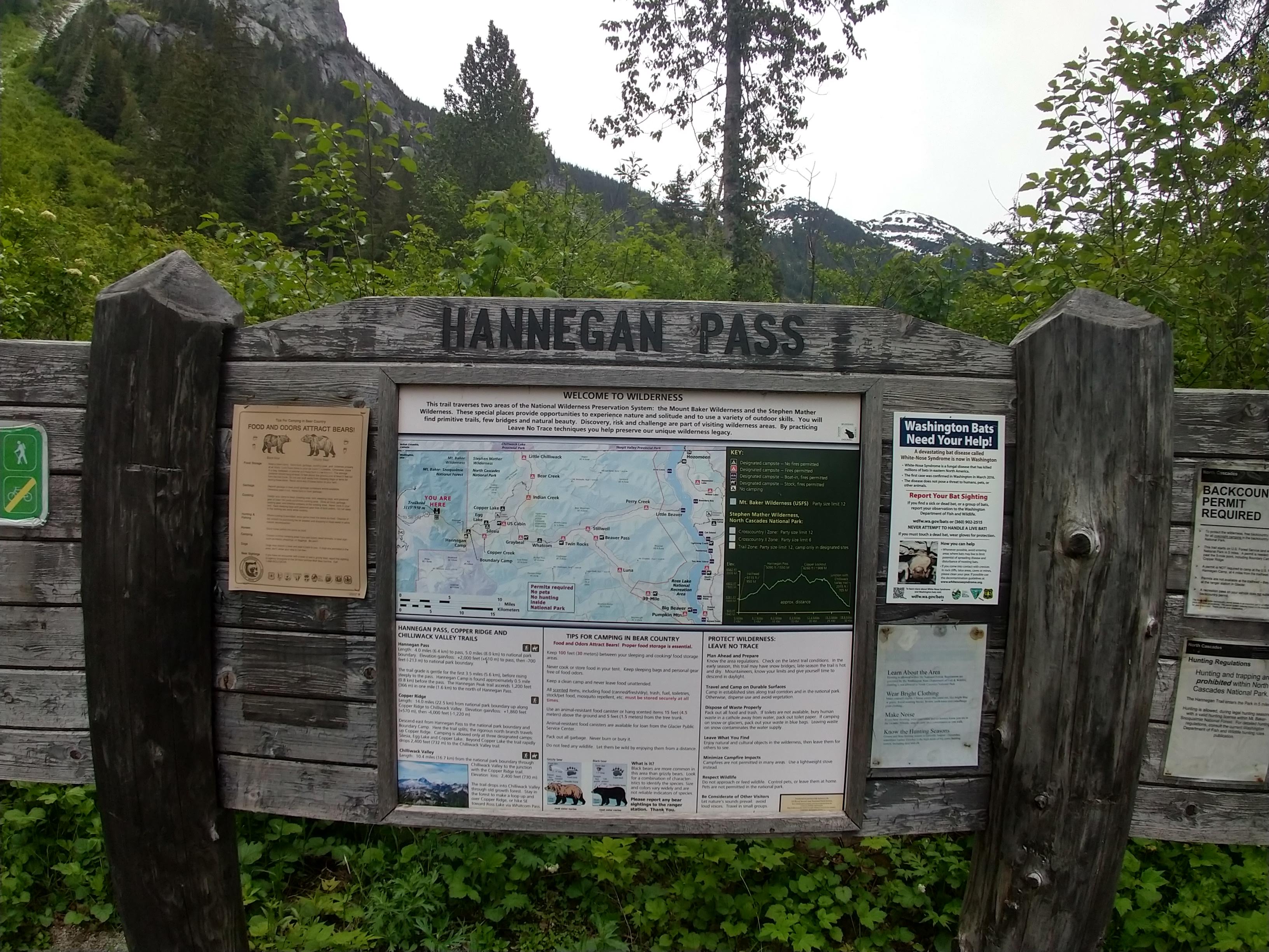
Permits:
America the Beautiful National Parks/Forest or the Northwest National Forest Passes are valid. If you don’t bring your pass, or just don’t have one, you can get a pass at the Glacier Public Service Center on your way in.
Day Trip:
Pack Weight Start: Did Not Measure, est 15lbs.
I arrived at the parking area around 3:30PM. There were 15-20 cars already, which wasn’t surprising given how late I arrived. The weather was in the lower 60s, and remained for most the hike. Since the weather looked like it could rain sometime during the trip, I stashed my light rain jacket in my pack just in case.
Trailhead to Hannegan Pass. 1hr 50min
From the get-go, the trail begins in the lower portion of the valley containing Ruth Creek without much significance for about the first half-mile. Then the views change drastically. If you are lucky to get a high cloud canopy or even clear skies, you will really enjoy the rest of the trek to Hannegan Pass. During my trip, there was a lot of lush green vegetation all along the trail. There were quite a bit of colorful flower clusters, but most aren’t ready to bloom. You’ll see a decent amount of purples, blues, reds and yellows as you’ll be able to see in several of the pictures throughout this post.


After the initial half-mile, you experience long open stretches in the valley where you’ll get to observe the north side of the Nooksack Ridge to your south side and the south side of the Skagit Range to the north. There are a few short sections of forested areas throughout the climb up the valley.


As you progress through the valley, you’ll begin to see Ruth Mountain (pictured above). There are also a few creek crossing along the way. Some are a step across, some have solid foot placements and some your feet might get a little wet. Somewhere along the way, it started sprinkling and misting, which helped keep the temperature down in the lower 60s. It roughly lasted til I got to Hannegan Pass, but again, nothing major and the views were still available.


About half a mile from Hannegan Pass you will come across the sign post for the Hannegan Pass Camping area. The area was still covered in snow, though there were relatively cleared areas to pitch a tent. This area is the last designated camping area in the Wilderness Area that doesn’t require a backcountry permit. If your trip continue past Hannegan Pass, you’re in the National Park and will need the appropriate Backcountry Permit.
At the sign post, you’ll keep left (clearly marked on the post as well). Not too far after the camping area, I encountered the first bit of snow,though its very intermittent (as seen in the pictures below).


Around 5:24PM, I arrived at Hannegan Pass. This is where you’ll need to keep to the left, rather than following the foot prints in the snow off to your right.
Hannegan Pass to Hannegan Peak. 2hr 44min (54min)
From the trail split, the snow is still intermittent, but there is more of it. I had put on my microspikes to keep from sliding around but hindsight it wasn’t critical. As you make your way up through the various switchbacks you eventually level-out on a more gradual sloping trail in the snow. From here the snow is unavoidable. There are some portions that have a more steep slope but most of it is semi-gradual to the top.
Nooksack Range Ruth Mountain Looking west along the valley toward where I started Hannegan Peak is in sight


Around 6:15PM, I arrived at Hannegan Peak. The following are the 360 views from the peak beginning at North and working my way counter-clockwise. This peak was my first hike in this particular section of the North Cascades. The northern views of Mt Shuksan were incredible. I can tell that I’ll have to make a trip to Ruth Mountain to get an even better perspective. Due low clouds around Mt Baker, I was only able to glimpse some of the lower base of the mountain.


The following pictures were taken as the clouds began to lift, offering a more highlighted view of Mt Shuksan and the valley I just hiked through.


After taking pictures, I sat-down to have some food and stare out at the surrounding peaks and valleys for about 15 minutes. It was about 6:20PM and I knew I could make it back to the parking area in about 2.5hr (~8:45PM), which would still be sufficiently light out.
Hannegan Peak to Trailhead. 5hr 3min (2hr 3min)
After wrapping up my food break and observations, I loaded everything back up, except I donned some work gloves to keep my hand warm and preempt the contact with the snow on the way back down. The initial stretch was through the snow which went by quick. There was an area that I was able to slide down. After 34minutes, I made it back to the post at Hannegan Pass, about half the time it took to get to the peak from here.
The rest of the pictures capture the return trip back to the parking area.


I arrived back at the truck around 8:37PM, just a tiny bit over 2hrs, which was roughly 30minutes faster than I estimated at the peak. All the other vehicles except one where gone. At this point mosquitoes were starting to take notice when I stopped so I tried to minimize my time getting set to make the drive back.
I will definitely be returning and possibly camping out at the peak. I can imagine the 360 view of the night sky on a clear night will render a spectacular stargazing experience.
Trip Metrics
- Total Mileage: ~10.4 miles
- Total Elevation: ~3100 ft
- Start Time: ~3:34PM Sunday 9 June 2019
- Finish Time: ~8:37PM
- Total Time: 5hr 3min
- Total Calories: 4181


Absolutely perfect trip report!
Many thanks for the detail and taking the time to do so.
Thanks!