Summary
Saturday hike along Sheep Mountain in Medicine Bow National Forest in Wyoming. This is a easy-moderate, non-technical hike. The difficulty increases if you hike the full round-trip trail. The views are mostly limited to the immediate areas you hike through, but occasionally there are some spots that provide overlook views into the valleys below. Mosquitoes were very active and a nuisance throughout the hike, except in the open areas when the wind was enough to keep them at bay. The roughly 21.7 mile round-trip took about 9hrs 50min.
(All pictures are clickable for larger views.)
Route Overview
Expand for more details

Elevation Profile from the Turnaround Point to Parking Area


In the above general route outline, the yellow was roughly the route. The trail is not always clearly defined and there were a few areas that I had to search for the trail. On the return trip back to the parking area, the trail was a little easier to see. The elevation profile provided depicts the return trip from the turnaround point back to the parking area.
Other Links:
- http://www.awayfromthegrind.com/hiking/wyoming/sheep-mountain-trail-centennial-wyoming/
- Hiking Wyoming’s Medicine Bow National Forest
Appropriate Maps:
There are not many resources for maps. I relied on the “Hiking Wyoming’s Medicine Bow National Forest” book by Marc Smith. Amazon Referral Link
- Sheep Mountain Guide
Overall Difficulty:
Moderate. The difficulty is highly dependent on the mileage. The trail is pretty easy going in terms of elevation gain, quality and composition. If you are just heading to Sheep Mountain, then I would rate the hike easy-moderate.
Gear Load-out:
Expand for more details
- Gregory Zulu 40L
- 3L Hydration Reservoir
- 2.5L Hydration Bladder Reserve
- Water filtration system
- First Aid Kit
- Compass
- 1x pair extra socks
- Food
- Light Down Jacket
- Light-weight warming layer
- Standard Slovenia Trip Loadout (clothes)
Getting to the Trailhead:
Expand for more details
From the Medicine Bow-Routt National Forest Center on the west side of Laramie, WY, drive east along WY-130W/Snowy Range Rd for about 21.7 miles. Turn left onto WY-11S. There is a sign directing you toward Albany, WY. About 8.4miles along WY-11S, you need to turn left onto Fox Creek Rd, which is the start of dirt/gravel. Be aware of livestock on the roads. After about a 1.6miles, turn left onto an semi-unmarked road toward Forbes-Sheep Mountain Wildlife Habitat. Less than half a mile you’ll arrive at the turnaround/parking area.
The parking area at the trailhead is decent, with room for maybe 10-20 vehicles depending on how people park and whether horse trailers/RVs are present. There is a bathroom structure at the parking area.


Google Maps Directions:
From the Medicine Bow-Routt National Forest Center on the west side of Laramie, WY to the Forbes-Sheep Wildlife Habitat Trailhead (click here)
Vehicle Clearance:
The road is paved the most of the way until you turn onto Fox Creek Rd, which become dirt/gravel road. There is no issues with vehicle clearance.
Permits:
There was no sign specifying a fee or permit area, but out of caution I used put my National Parks/Forest Pass in my windshield since the area is part of the National Forest. America the Beautiful National Parks/Forest Pass is valid throughout Medicine Bow-Routt National Forest areas.
https://wgfd.wyo.gov/Public-Access/WHMA/WHMA/Forbes-Sheep-Mountain
Restrooms:
There are a restroom structure at the parking area.
Day Trip:
Pack Weight Start: Did Not Measure, est 30lbs.
I arrived at the parking area around 8:30AM. There was one other vehicle that had camped out over night in the parking area, but no others where on the trail. The temperature was in the mid 60s in the parking area, and remained that way for most the hike. The weather was pretty clear when I arrived but started raining and thunder-storming during the final 2 miles back to the parking area.
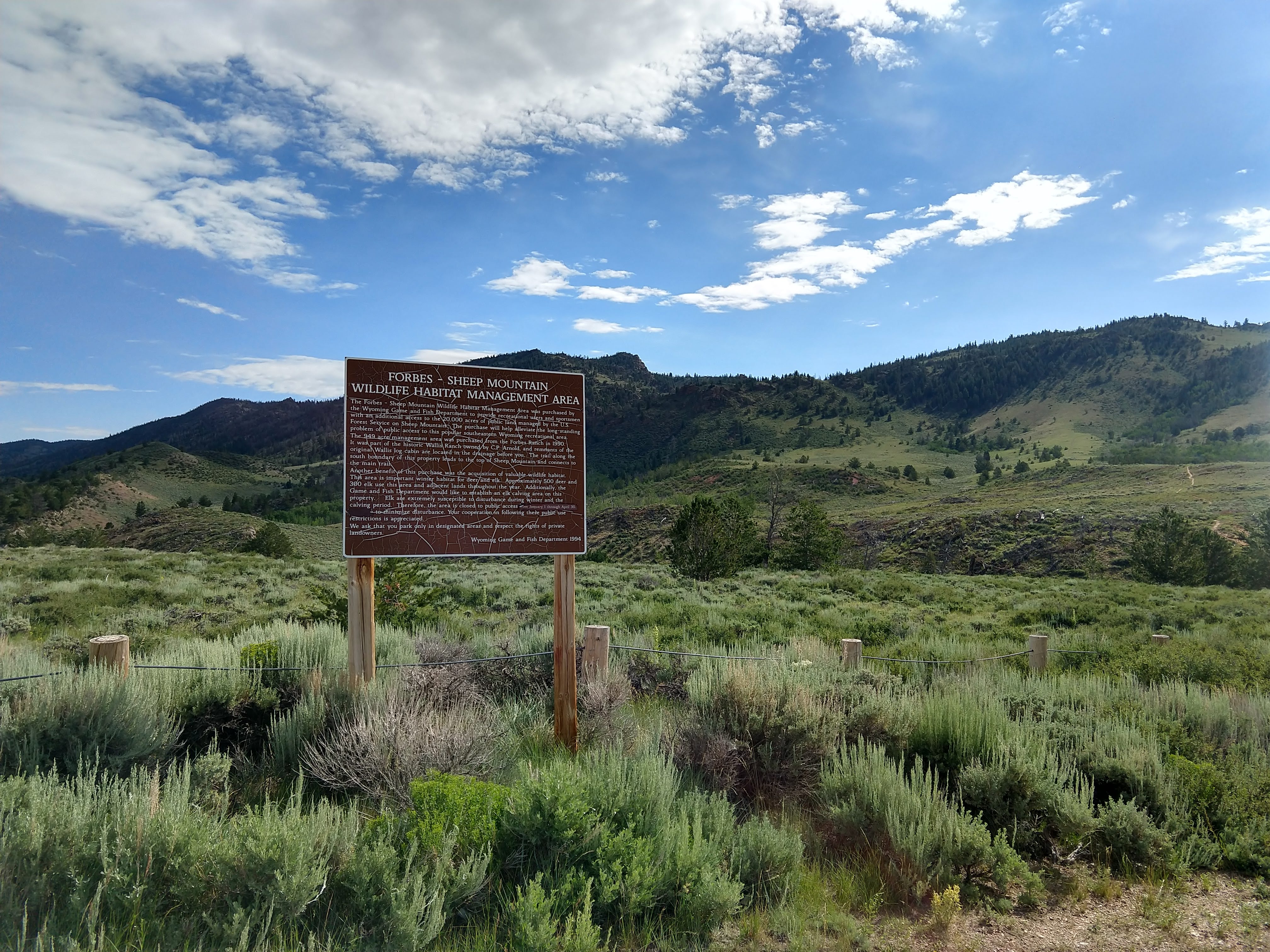
Trailhead to Trail Split. 55min
At the trailhead there are some signs with various information and maps about the rules of use for preservation of the Habitat Management Area. Please be responsible and pickup after yourself!

I eventually took off down the trail around 9:30AM. The trail starts out with a gradual gain in elevation from the parking lot along a well traveled path. The open space is is mostly prairie grass, sage brush and wildflowers. The trail is well traveled and defined.


Pretty soon you’ll arrive at the fencing intersection marking the Medicine Bow National Forest Boundary (entering). From here you follow the trail continuing to the southern ridge like, with plenty of views of the valley behind you. While it was clear to the south, I was able to see some of the mountain ridge lines in northern Colorado, which still had some traces of visible snow on their north sides.


Coming from Washington state, the soil, vegetation and rocks were very different. Several patches of trees were clearly affected by the bark beetle as well. The trail initially intersects with a trail/dirt road that approaches from the south. Continue straight (left at the intersection or generally north/east). This is not the trail split just yet.


The last picture above, you can see the northern Colorado mountain ridges (far background). Off to the left in the middle-ground, you can see Jelm Mountain. As you continue only the trail, you’ll notice a couple signs indicating trails and distances. The first sign indicates that its about 2.5miles back to the parking area. The other sign says its about 3.5miles back to the southern Fox Creek Road access. Continue along Sheep Mountain Trail (No. 386)


Trail Split to Sheep Mountain. 3hr 30min (2hr 25min)
Keep straight along the Sheep Mountain trail. Eventually you’ll come to a campsite type area. The trail splits, but you’ll want to keep left. At the time there was an arrow made of sticks on the ground directing you. I had missed this feature on way out and ended up lossing the trail and had to wonder around before finding it again. The path the right takes you along the marsh land area. The resembles more of an animal path.


The following depicts the two paths you can take. Stay to the left here to for any easier time on the defined trail.

As you follow along the trail, you’ll notice lots and lots of fallen trees across the trail. Typically there were yellow (majority) and pink flagging ribbons on the branches of the fallen trees to help keep you on the trail.


There isn’t much elevation gain during this segment until the final mile leading to the Sheep Mountain scenic area, but even this its not drastic.


Sheep Mountain to Turnaround Point 5hr 27min (1hr 57min)
From the Sheep Mountain scenic area, you traverse along the ridges, going up, down, and around some of the small peaks. Luckily the mosquitoes were pretty scarce so they wouldn’t swarm you as much when you stopped. There were lots of interesting rock formations and weathered trees along the ridge. On occasion you could get some views looking northwest toward Snowy Range.


Eventually the trail began descending back toward the northern end. When you reach the following sign, the trail gets pretty rough, and at the time the mosquitoes got progressively worse. Shortly after passing the sign, I got fed up with the mosquitoes and the obstacle course that was the trail so I turned around rather than press on to the northern trailhead, which wasn’t far away.


Turnaround to Trailhead. 9hr 52min (4hr 25min)
After turning, I began thinking about a place to stop to take in some nutrition and refill by main water bladder with my reserve bladder. I would also need to reapply some bug spray to ward off the aggressively hungry mosquitoes.

Just slightly passed the sign (last picture above) there was a side trail on the right that went up toward Sheep Mountain North. Luckily not too far up there was a clearing where the wind was just enough to keep the mosquitoes at bay while I ate and took care of my return trip tasks. The views below depict the surrounding area where I stopped, which provided much better views than being in the draw where the path was.


On the way back the clouds were starting to build and thunder could be heard in the area. It also began sprinkling off and on back to the Sheep Mountain scenic area.


I arrived back at the Sheep Mountain scenic area, which looks like a great area to camp with full view of the night sky, after about 2.5hr from the turnaround point. By this point, the thunder was more prominent and closer.


Rain to the north near Centennial


After the pictures above, it began lightly sprinkling steadily while increasing in intensity all the away back to the parking area. This was a good feeling cool off to end the roughly 21.7mile hike.
Trip Metrics
- Total Mileage: ~21.7 miles
- Total Elevation: ~4370 ft
- Start Time: ~9:34PM Saturday 20 July 2019
- Finish Time: ~7:28PM
- Total Time: 9hr 52min
- Total Calories: 7368


What brand of bug spray do you like best?
I used Sawyer SP543 (Picaridin) spray during my Sheep Mountain hike, but later in the trip I treated by gear with Sawyer SP657 Permethrin. with topical application of the Picaridin spray at the trailheads.