Summary
Sunday afternoon hike up to the Gap Lakes in the Medicine Bow National Forest in Wyoming. This is a easy, non-technical hike. The trail offers panoramic views of the Snowy Range. Once you hit the saddle separating North and South Gap Lakes, you gain additional panoramic views looking northward. The roughly 5.2 mile round-trip took about 2hr 55min.
(All pictures are clickable for larger views.)
Route Overview
Expand for more details


In the above general route outline, the yellow was roughly the route. The trail is clearly defined. The elevation profile provided depicts the return trip from the turnaround point (North Gap Lake) back to the parking area.
Other Links:
- Hiking Wyoming’s Medicine Bow National Forest
Appropriate Maps:
There are some resources for maps. I relied on the “Hiking Wyoming’s Medicine Bow National Forest” book by Marc Smith. Amazon Referral Link
- Gap Lakes Trail Guide
- Hiking Project
Overall Difficulty:
Easy. Elevation gain is mostly gradual throughout the hike going out to the Gap Lakes. The trail does go through rocky area. Due to the general altitude of the hike, it may be more difficult for some, especially for those coming from sea level. The parking area sits at around 10,725ft, while the highest point is a little over 11,000ft.
Gear Load-out:
Expand for more details
- Gregory Zulu 40L
- 3L Hydration Reservoir
- First Aid Kit
- Compass
- 1x pair extra socks
- Food
- Light Down Jacket
- Gloves
Getting to the Trailhead:
Expand for more details
From the Medicine Bow-Routt National Forest Center on the west side of Laramie, WY, drive east along WY-130W/Snowy Range Rd for about 41.8 miles. Turn right into the West Marie Lake Trailhead parking area.
The parking area at the trailhead is quite small given the popularity of it (at the time I was there is late July). There maybe room for maybe 15-20 vehicles. This is a popular hiking area so the parking can get full quick. Part of the parking limitations is the gate is closed, which if open would allow more people to drive up to Lewis and Libby Lake parking areas.
Google Maps Directions:
From the Medicine Bow-Routt National Forest Center on the west side of Laramie, WY to the Upper Snowy Range/SugarloafTrailhead (click here).
Vehicle Clearance:
The road is paved the whole way with no issues needing high clearance.
Permits:
America the Beautiful National Parks/Forest is valid. There are day passes available at the trailhead.
Restrooms:
There is not a restroom structure at the parking area, but there is one at the next pull off past the trailhead (Libby Flats Observation Area). There are some restroom structures at Libby Lake and Lewis Lake.
Day Trip:
Pack Weight Start: Did Not Measure, est 15lbs.
I arrived at the Sugarloaf parking area around 10:30AM. By that time there were only a couple small spots left. The weather was great with mostly clear skies in the mid 70s, both conditions remained for most the hike, although the there were steady breezy periods and when I stopped to break at North Gap Lake, it really got chilly and windy.
Trailhead to Trail Split. 34min
I departed the parking around around 10:50AM, after reshuffling my gear. From the trailhead, you walk on the closed off road through to Lewis Lake. You still get some good panoramic views of Snowy Range along the road so you wont be disappointed. The following pictures give you a sampling of the views.


Once you reach the end of the road at Lewis Lake, you begin walking along the clearly defined trail. The first couple of pictures in the next bunch depict the picnic area, the lake views and the trail sign indicating various distances to locations. There isn’t much elevation gain during this initial segment. When you get to the trail split sign, you would be able to really extend the overall mileage, especially if you completed the entire Alpine Lakes Loop (~11.8miles; link).


Trail Split to North Gap Lake(turnaround). 1hr 17min (43min)
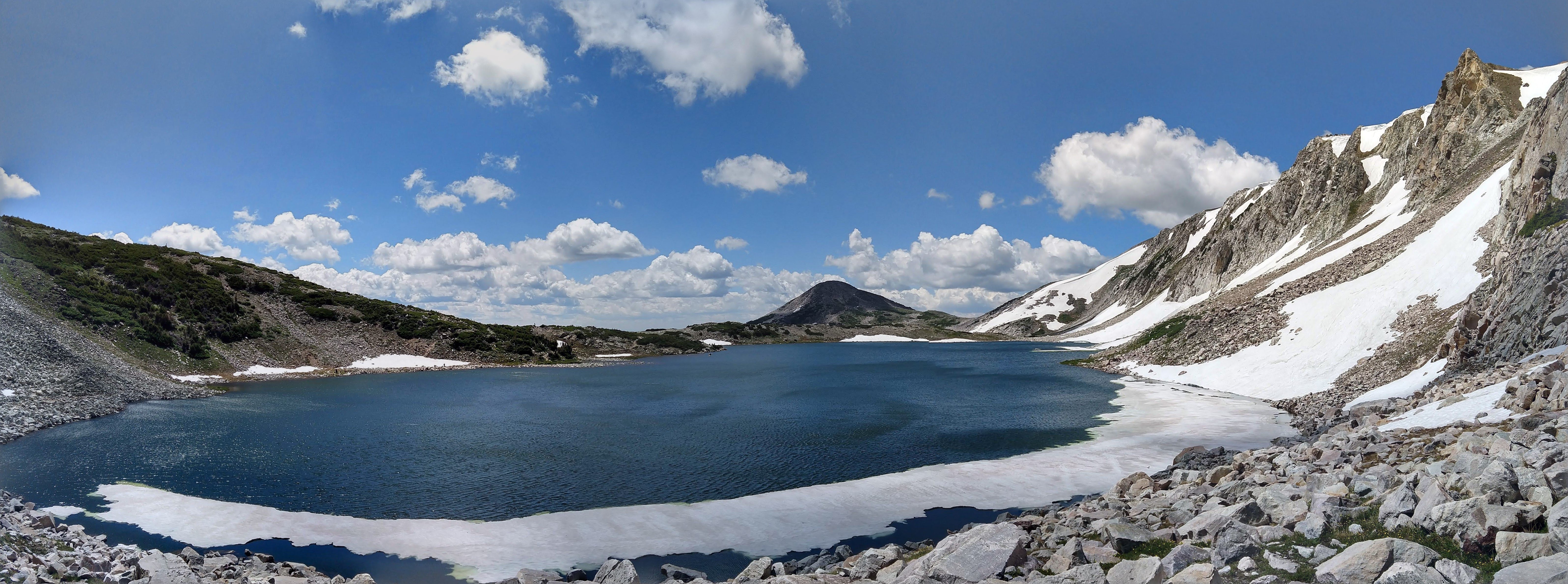
The rest of the hike had a little more elevation gain, but not much. The views were really spectacular. The following photos are just a sampling of the sights.


Once I arrived at North Gap Lake, I sat down for a little bit to eat and take in the views. I didn’t really have any other afternoon plans so there was no rush to get back. I had considered continuing on from here to do the whole loop but figured I would save that for another time, when my boots somewhat dry. By this point my boots were still soaks.

North Gap Lake to Trailhead. 2hr 55min (1hr 14min)
The walk back was way more windy than on my way out but it felt quick good. The following are just more scenic pictures of the area all the way back to the parking area.


I got back to the Sugarloaf parking around around 1:46PM but decided not to hang out since there were some vehicles looking to park and go hike. I would certainly recommend this hike to a wider audience since even just walking to Lewis Lake is quite easy with family and young ones, especially for the views at each of the lakes.
Trip Metrics
- Total Mileage: ~5.2 miles
- Total Elevation: ~955 ft
- Start Time: ~10:51AM Sunday 28 July 2019
- Finish Time: ~1:46PM
- Total Time: 2hr 55min
- Total Calories: 1239

