
Summary
Sunday morning hike and snowshoe near Sourdough Mountain in the North Cascades National Park with a friend. This is a non-technical hike that is strenuous, especially with snowshoeing conditions. The normal trail to Sourdough is exposed to several avalanche zones. The snowshoe route avoids these by traversing along the ridgeline. There is quite a bit of elevation gain along the winter route. South and Eastward views most of the way with several openings as you travel through the wood to higher elevations. The weather cooperated with us, giving way to partly cloudy skies and decently warm temperatures the entire way. There were about 5-7 other hikers on the trail during the outing. The hike took us about 8.5 hrs, including a couple decent breaks.
(All pictures are clickable for larger views.)
Route Overview

Generalized Route Overview Generalized Route Elevation Profile


In the above general route outline, the yellow was roughly our route going to, while the purple is part of the return route. We followed a set of tracks going up because it was more near where the real trail should have been but ended up heading toward the ridgeline rather than traverse the side of the ridge where the normal late-spring and summer path would be. The the return there was a more clear path that others had taken.
During this outing, I experimented with the Gaia app after we got into the snow line. At the lunch point, I began to record our tracks for the rest of the trip, which highlighted the deviation of paths much more prominently.
Washington Trail Association Links:
- Sourdough Mountain
Overall Difficulty:
Strenuous. Solid elevation gain over the first two miles. Snow began around 4000 ft. Dependent on the snow-pack and your conditioning with snowshoeing.
Gear Load-out:
- Gregory Zulu 40
- Snowshoes
- Microspikes
- 3L Hydration Reservoir
- First Aid Kit
- Glacier glasses
- Light weatherproof jacket
- Light down jacket
- Beanie
- Neck gaitor
- Layered glove system [read more]
- Compass
- Map
- Over-boots (for my approach/hiking shoes)
- 1x pair extra socks
- Food
– – – – – – – – – – – – – – – – – – – – – – – – – – – – – –
Getting to the Trailhead:
From the Skagit Information Center at Newhalem, WA, drive east along WA-20 for about 5.3 miles. There will be a sign to turn left onto Diablo St before you cross the long bridge. After driving past the residential area, you will see some maintenance structures and a fenced tennis court. Parallel park along the road next to the signs.

The parking lot is paved. There was no bathroom structure at the parking area, but there is at the Gorge Overlook Trail turnoff before you get to Diablo St.

Google Maps Directions:
From the Newhalem, WA to the Sourdough Trail Parking Lot (click here)
Vehicle Clearance:
WA-20 is paved with no issues. Diablo Street is paved with no issues. Low clearance vehicle accessible.
Permits:
According to the flyer at the trailhead sign, the National Forest/Park pass is not needed at Park Service trailheads. If you are planning to camp overnight, you do need a Backcountry Permit, which can be obtained at the Marblemount Ranger Station. The Backcountry permit is free.
Day Trip:
Pack Weight Start: Did Not Measure, est 15lbs. No picture.
Sourdough Trail Parking Lot to Park Boundary. 2hr 15min
Starting about 9:45AM, there were plenty of parking spaces. Since it was Easter Sunday, this may not be as typical. The temperature was in the upper 40s/low 50s in the parking area and mostly clear skies. The trail sign is across from where you park, but the actual trail entrance is about 150ft from the sign (direction at the trailhead sign).
The trail begins climbing as soon as you start and doesn’t let up for the next hour or so as you tackle switchback after switchback through moderately dense forest. There are a few peek-a-boo spots though so its not all trees. After the first hour on the trail, the trees thinned out in some areas, allowing for more views, mostly of Davis Peak to the west or Pyramid and Pinnacle Peaks to the south.
Only bridge crossing, within 10minutes of the trailhead Pyramid and Pinnacle Peak to the south More Pyramid and Pinnacle Peak views higher up National Park Boundary First major view looking south toward Pyramid, Pinnacle and Colonial Peaks


After about 2 hours and 15 minutes we arrived the first major overlook area, which happens to be near the National Park Boundary. There is a wooden post indicating the boundary of the two areas.
Park Boundary to Lunch Break. 3hr 30min (1hr 15min)
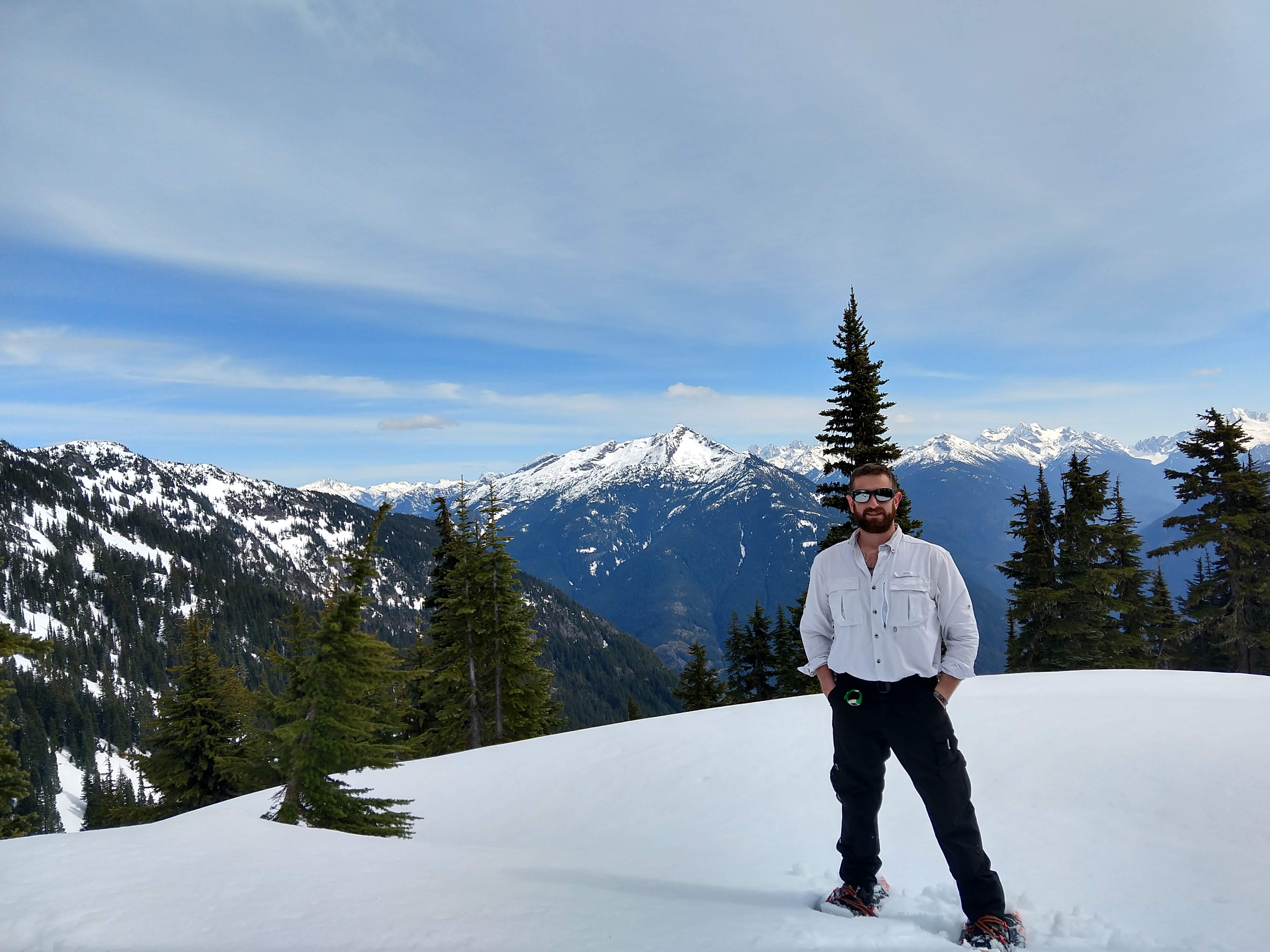
Once you get to the Park Boundary, the snow become more substantial. On the way up, the snow seemed to start around the 4000ft mark but was only light. It wasn’t much further past the boundary marker, where we put on our snowshoes.
We tried to follow the tracks in the snow that were somewhat near were the trail should be but we eventually lost the tracks. Since slope where we were was a bit much to continue along the contour, we decided to push our way up to the top of the ridge. The maps indicated the slope would be more gradual. The ridge line would also take us toward Sourdough Mountain as well. While we were assessing the map and our location we broke for some lunch. The views below give an idea of what we could see generally where I marked our position on the map above. The normal trail, as depicted on a map would be a more feasible approach likely in late-Spring.
Looking through the trees to toward the lower part of Sourdough Mountain/Ridge View Eastward View South/South-East toward Ruby Mountain View South overlooking Diablo Lake with Red Mountain, Mt Logan and Buckner Mountain in the far background


Lunch Break to Ridge Top. 4 hr 50 min (1hr 20min)
After a brief lunch, we pushed upward toward the top of the ridge. At this point, I began recording our tracks using the Gaia app. During this time, it was a pretty good reference to see were we were, were the trail was and we better fidelity of the topology of the ridge line to make a better decision in comparison to the North Cascades National Geographic Map we had.
The following pictures depict the route up toward the top of the ridgeline.
Peak through to Colonial Peak and Buckner Mountain Looking toward the Sourdough ridgeline Heading up to the ridgeline


The more we gained the better the views up the to ridge line. Most of the views are of the southern mountains in the region
Ruby Mountain in the background Panoramic View as we gained more elevation on the ridge More unobstructed view toward adjacent ridge.


Due to the timing of our progress thus far, we decided to end the hike at the ridge top were we could sit back and take in the views over a beer. Given another hour or so past where we stop, you could get to Sourdough Mountain by following the ridgeline. The slope just below Sourdough Mountain would likely not be a good approach due to evidence of recent avalanche, especially given its slope angle and southward face.
View North toward Sourdough Mountain View North/NE toward Sourdough lower ridge View East View South View South/SE toward Ruby Mountain View South


Through the trees west of where we were, you could get some glimpses of the western mountain but nothing substantial. We would’ve needed to continue along the ridgeline toward Sourdough Mountain to get more views west and north.
Ridge Top to Park Boundary. 7hr 10min (2hr 20min)
Once we finished up our long break we headed back. Along our route back we saw were the other trail of tracks had came up. We looked at the map and decided to follow those tracks back down since they were more prominent.
Along the trek back down we had the southern mountains in our view the whole time, which caused us to stop frequently at the way back down as well. As we continued down the cloud started moving in the area which obscured some of our views.
View west toward Davis Peak Our last substantial view of the southern landscape


The way back to the Park Boundary went by pretty quickly in comparison to the way up, but we did encounter a few tricky spots where we lost track of the trail as the snow thinned out. There were a few slick areas were the snow had warmed up enough that sliding down some sections was easier, and more fun.
More closer to the Park Boundary we switched out to microspikes to have better control since the snowshoes at some points were becoming less practical and more cumbersome.
Park Boundary to Parking Lot. 8hr 35min (1hr 25min)
At the Park Boundary area, we removed our microspikes and continued along the trail. The way down went by much quicker than expected and we trimmed about 50 minutes from our time in comparison to the morning coming up.

When we arrived back at the parking area, all the cars except one were gone. Another good hike in the books. I’ll likely re-attempt this hike in early-Summer to get a better idea of the actual trail and conditions, as well as to check out the fire lookout tower. I would likely do this trail again next winter and now that I know where the winter trail is, we can make better time and get to the summit of Sourdough.
Trip Metrics
- Total Mileage: ~8.0 miles
- Total Elevation: ~4858 ft
- Start Time: ~9:50AM Sunday 21 April 2019
- Finish Time: ~6:20PM

