After taking off a little earlier from work the day before my arrival in the Tetons, I got all the way to the Blackfoot, ID rest stop. This was roughly 12hrs of the 14hr total. As I normally do on road trips across the country, I slept in the crew cab portion of my truck until morning then proceeded to make my way to the Tetons. So far this was on par with my initial travel planning for the trip.
Teton Village
I arrived at Teton Village around 1030 AM on 13 September 2018. Initially I was planning to go straight to Alta, WY to hike Table Mountain first. However, after considering my friends’ advice, who made a trip to the Tetons the year before, along the drive I decided to spend the first day acclimating to the altitude. The my base elevation during this trip was now in the 6000+ft range, rather than my 200ft above sea level home. My friends had suggested spending the day at the top of the Jackson Hole ski resort. There is a air-tram that takes you to the top, although it was more costly than I was expecting. $43 later for an all day pass and I was on my way.
Quick Note: There are lots of trails on the mountain and you could easily hike up to the top within 8miles one way. Based on my objectives, I took the tram
The tram was making runs every 15 minutes so I went back to the truck to grab my gear for the day. Just a small day pack with water, a little food, map, camera (w/ tripod), warming layer and Bear Spray. After a short wait for the next tram to arrive, I boarded and was quickly whisked away up the 4000ft elevation difference. I got to the top around 1130/1200.
At the top of Jackson Hole
For starters, the weather was mostly cloudy at the bottom and not much different at the top, though there were pockets of blue skies and sunshine. When I got to the top (elevation 10,450 ft), the temperature was noticeably cooler (mid-60s at Teton Village vs mid-40s at the top). There were a lot more gusts of wind and several dust devils forming and disappearing.

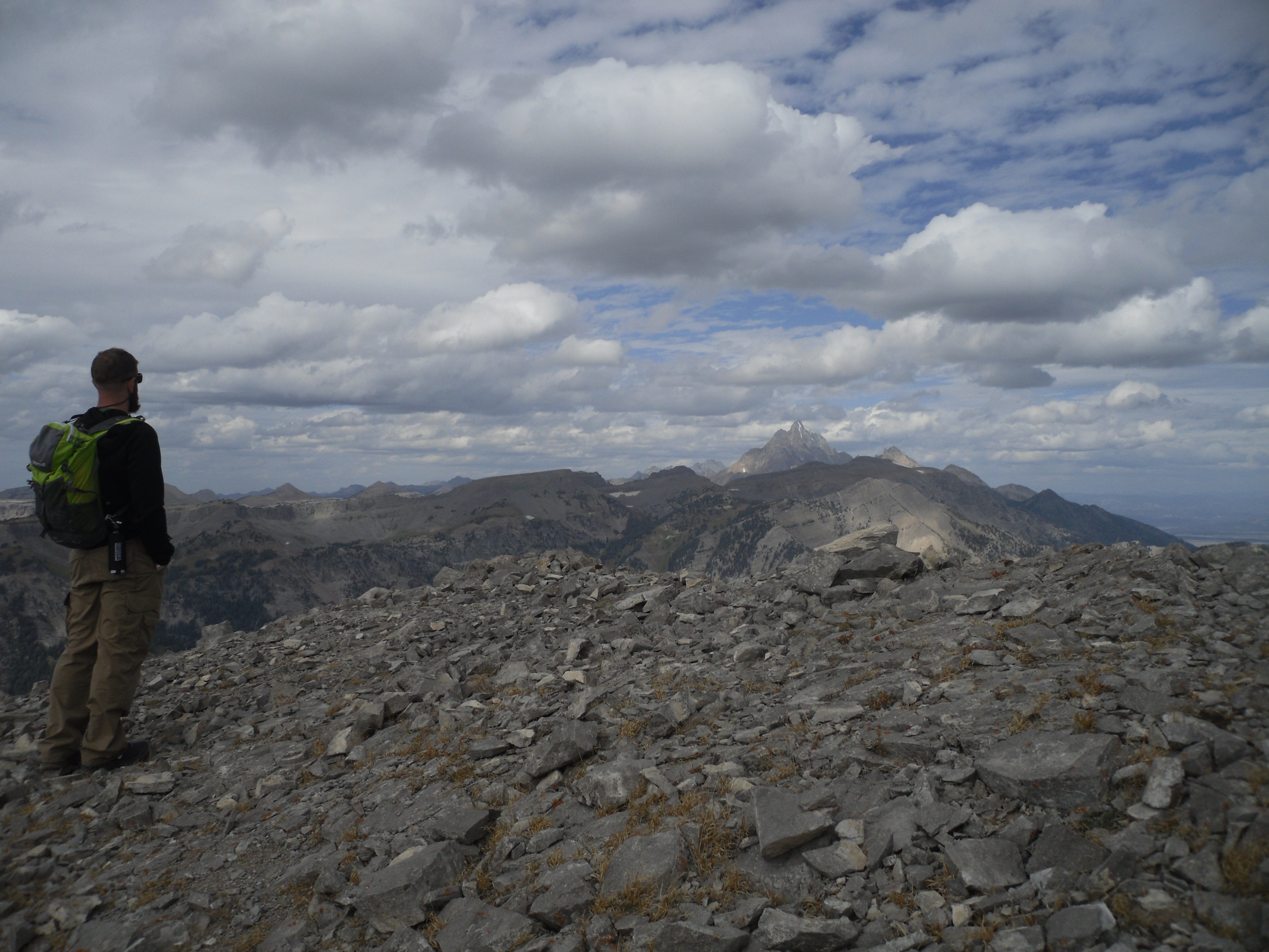
View South toward Rendezvous Mountain View North Toward the Grand Teton View SE in the valley of Jackson Hole


I took some time taking pictures and reviewing the map to understand the surrounding terrain features. I decided I should begin my hike soon to keep warm. (Link to high res hiking map). At first I thought I would just do Top of the World, Summit Trail and Rock Springs Loop, but Rendezvous Peak was looking enticing. The trail wasn’t exactly on the maps, but there was definitely a defined trail I could see. Eventually I could see a couple of folks returning along the trail so why not check it out.


Hiking to Rendezvous Peak
Once I checked my gear and made my bear spray quickly accessible, I started my trip. When I got to the bottom of the little hill before the start of the climb up, I set a timer on my cell phone for 1hr 45min. This would be my drop dead time to turn around and head back to ensure I got back in time for the last tram ride down to the Village at 5:30 PM. When I passed by the folks returning, I asked them how long it took them to get to the top, and they said a little over an hour. Based on my current time, I figured that should be easy.
Start of the ascent toward Rendezvous Peak (tallest peak on left)

The first part was a little bit of a rock scramble. There were definitely areas that were exposed, so if you are afraid of heights and not comfortable scrambling, then avoid this hike. There are plenty of hikes in the area that don’t involve scrambling or exposure. Once at the top of the scrambling section, the rest of the hike was pretty much a talus and scree trail.
Rocky trail after the scramble Looking back toward the tram area


Here are some more of the views further along the way toward the peak.
NW Landscape There’s the Peak


At Rendezvous Peak
When I got to the top of Rendezvous Peak, the wind had picked up significantly so I had to crouch to keep my profile low. There isn’t much space up there and both sides are quite exposed with steep drop-offs. After looking at my timer, I made it to the top in about 42 minutes. This allowed for plenty of time to sit up top, eat some food, take some pictures and observe the surrounding landscapes.
View to the W/NW of Rendezvous Peak View to the N of Rendezvous Peak View to the NE of Rendezvous Peak


View to the SW of Rendezvous Peak View to the SE of Rendezvous Peak View to the W/SW of Rendezvous Peak View to the W of Rendezvous Peak


For food, I had some of one of my granola concoctions with pumpkin seeds, figs, banana chips, semi-sweet dark chocolate chips, and dried blueberries. This combination proved to be great throughout the entire trip. Calorie dense, nutrient rich, and a variety of flavors that kept it interesting.

Returning from Rendezvous Peak
The hike back was pretty quick from the Peak back to the scramble area. The scramble seemed a little more difficult going down, which was in part because I didn’t go back the same route I took to get up because the path is hard to tell. I took my time making my way down so as not to slip and skid down. The rock was loose and I had to feel around to make sure I had good hand and foot holds. Eventually I got back with plenty of time to spare.
When I made it back to the little lodge at the top near the tram platform, I took the time to review the map some more and take in the views of the Jackson Hole valley. While I was observing my surroundings, the temperature seemed to have dropped a little and the moisture that was coming down was a little bit sleet and a little bit snow. Something I certainly don’t experience in early-mid September.
Ending of the Day
As 5:15 rolled around, I boarded the tram to head back down to the village. I started thinking about dinner. Luckily the tram operator was talking about $3 pints at the Alpenhof in the Village, so that made where I was going next much easier.
Over the course of 2 pints and a burger later, I had reviewed enough of my routes and the maps to know some of the various options that I would pursue during the backcountry permitting process in the morning. The tricky part was to make sure I wasn’t over doing it, as well as underestimating. Around 8:30 PM, I headed back to the truck to get some sleep so I could start the next day well rested.
Initial Elevation Performance
During the entire day, I monitored my heart rate with my Polar FT4 so I could better understand how my heart rate and pacing were affected by the elevation. It seemed that my conditioning and daily workouts leading up to the trip helped with my endurance and controlling my breathing. Although I had to make a few extra stops to catch my breathe, the duration of the stops were pretty short.
Average Heart Rate: 115 bpm
Max Heart Rate: 175 bpm
Total Miles: 3.26 miles
Elevation Gain: 1657ft
Total Calories burned: 2790 (11am-4:30pm)

